The latest UK weather maps have revealed a huge snow bomb could be set to hammer the country in a huge blow to millions of Britons hoping for warmer spring weather.
While the sun may be shining this weekend across much of the UK, new weather maps by WXCharts have predicted a substantial chunk of the nation will once again be battered by bitterly cold weather and snowy conditions later this month.
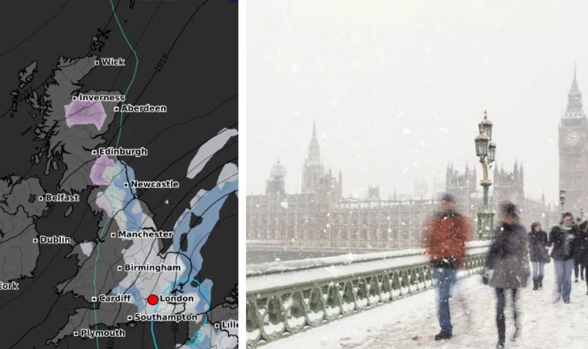
The maps for March 11 show a vast white blob blanketing an area stretching from Brighton on the south coast all the way up to Newcastle, with London, Cambridge, Nottingham and York not escaping the flurries.
According to WXCharts, locals in these areas of England should expect to see at least 1cm per hour of snow.
Scotland and Wales will not escape the snow bomb either, but to a lesser extent on this occasion. A small area on the northern coast of Wales - around the Conwy region - could also see up to 1cm of snow per hour on March 11.
Scots living south of Edinburgh, near the border with England, as well as a substantial area near Inverness and the Cairngorms, unsurprisingly, should also expected to have several centimetres of snow already blanketing the ground.
Mixed in amongst the snow flurries are also stretches of rain, which could reach up to 1mm per hour in areas including Kent, Norfolk and Newcastle.
This time around, it looks like much of the West Country will escape this latest bought of snow and bitter temperatures on this occasion, as well as Northern Ireland.
Another weather map from WXCharts shows a huge band of freezing air hovering over the UK on March 11 that could see temperatures plunge below 0C across much of the country.
The Met Office's forecast for March 3-12 states: "A split in weather conditions is likely across the UK during early March. Northwestern areas will see bouts of rain and stronger winds at times, as Atlantic weather systems arrive from the west.
"These spells of wet and windy weather will move southeast to some degree.
"However, high pressure is likely to have more influence across the south of the UK, at least at first. Here, there should be a good deal of fine/dry weather during early March with a chance of night frosts and morning fog patches.
"Through this period, there is an increasing chance of unsettled conditions becoming more widely dominant across the UK. Temperatures generally around or a bit above average, notwithstanding some chilly nights."


Comments
Leave a Comment